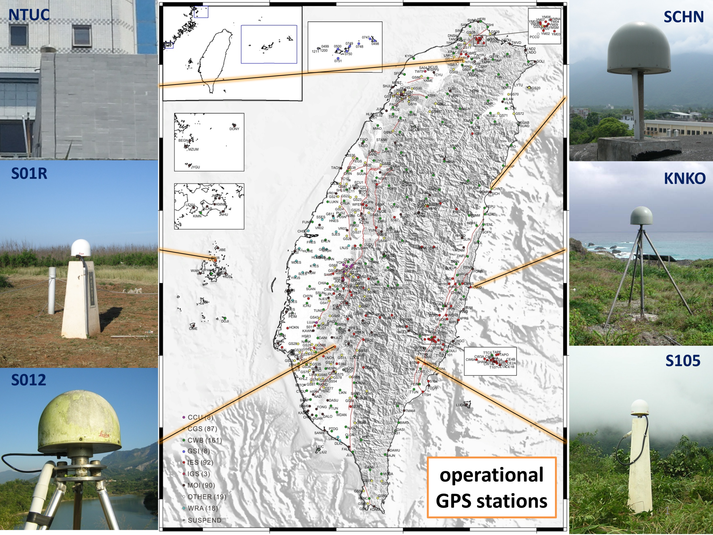
My research focuses on crustal deformation and geohazard monitoring using integrated geodetic observations, including Global Navigation Satellite Systems (GNSS), seafloor geodesy (GNSS-Acoustic), precise leveling and Interferometric Synthetic Aperture Radar (InSAR). By combining high-precision onshore and offshore time-series data, my work aims to investigate tectonic processes and geodynamic phenomena in Taiwan and its surrounding regions, including earthquake generation, co-seismic and postseismic deformation, slow slip events (SSEs), volcanic activity, and rainfall-induced surface deformation and landslides.
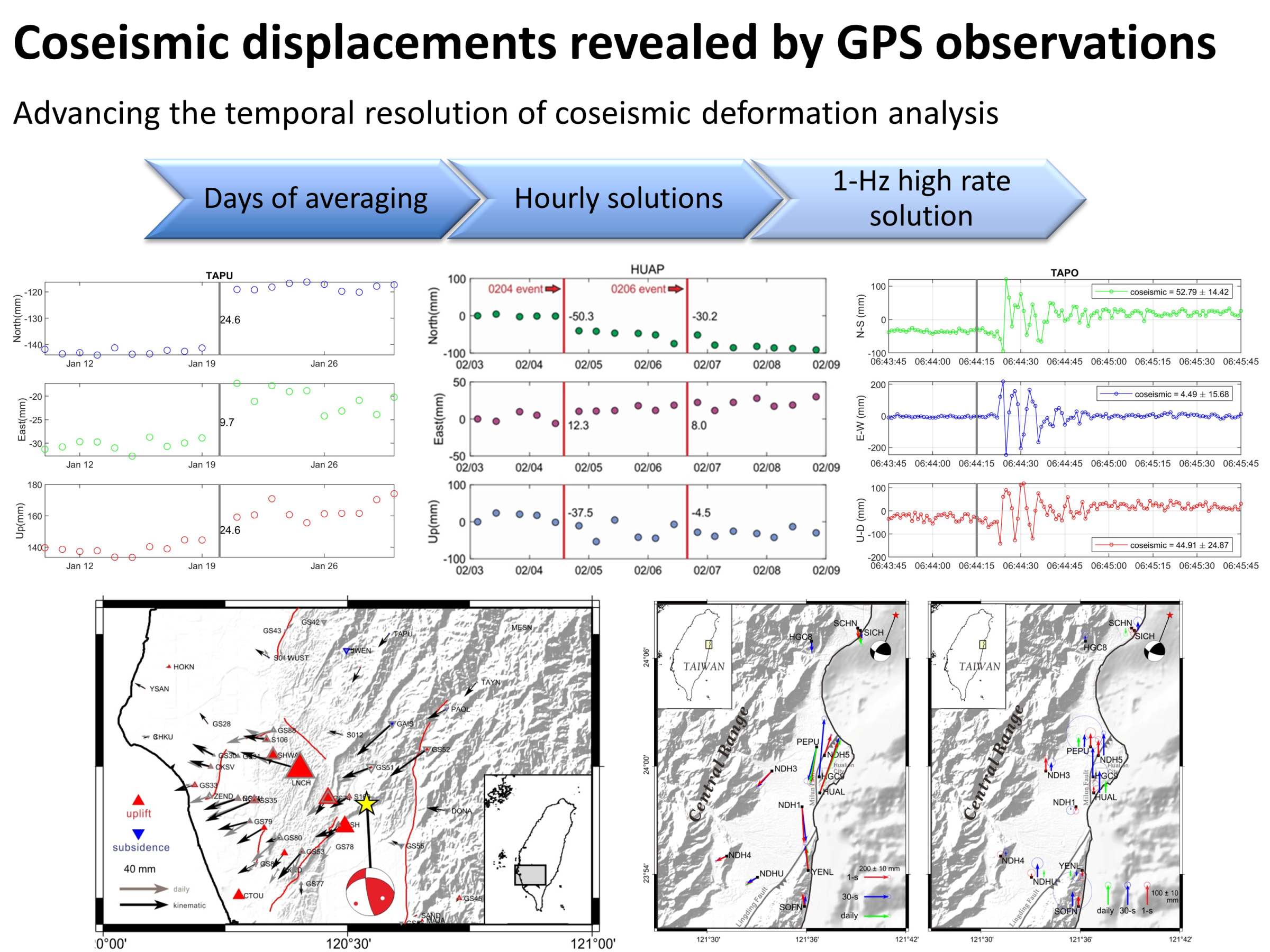
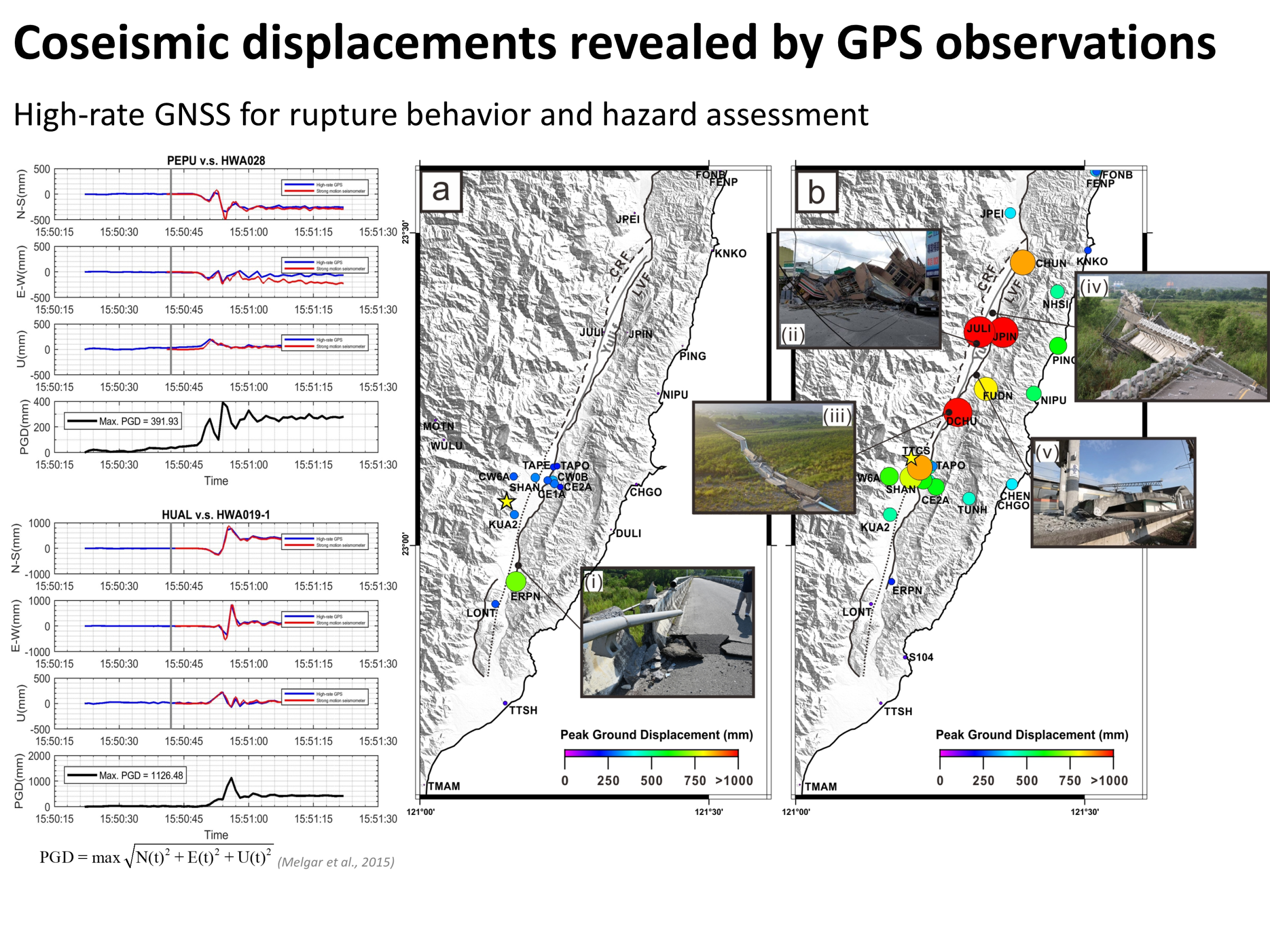
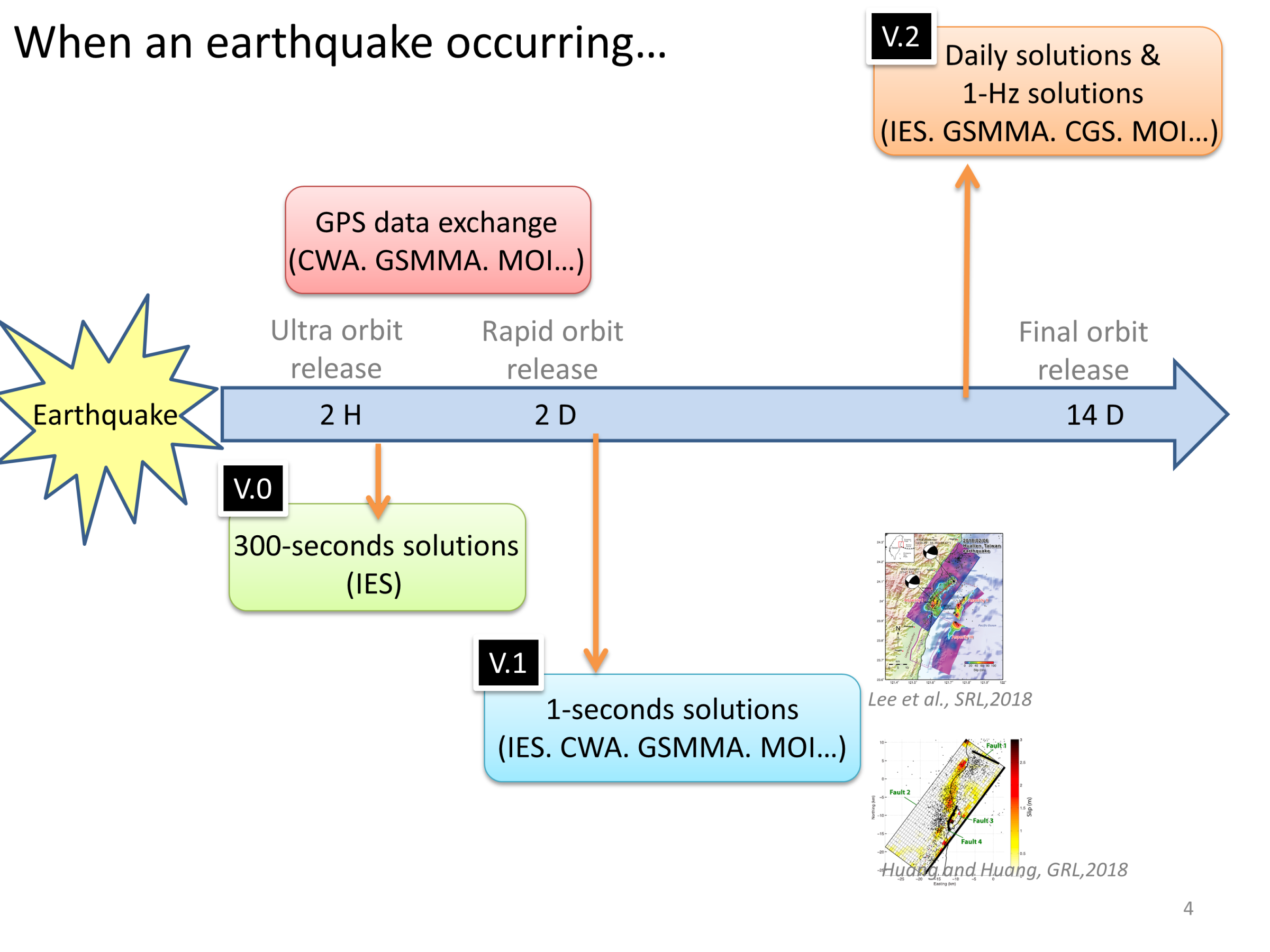
Methodologically, I focus on developing standardized and high-quality geodetic data processing workflows and products, while advancing GNSS data processing techniques, including multi-constellation integration (e.g., GPS, GLONASS, Galileo), to improve positioning accuracy and solution robustness. This work encompasses GNSS time-series analysis, velocity field and strain rate estimation, seafloor acoustic positioning inversion, and multi-sensor data integration (e.g., GNSS, InSAR, seismic, and hydrological observations). I also develop automated and semi-automated processing and quality control frameworks to enhance the stability and reliability of long-term monitoring datasets.