Participants: Yunung Nina Lin and Yi-Ching Chen (Academia Sinica)
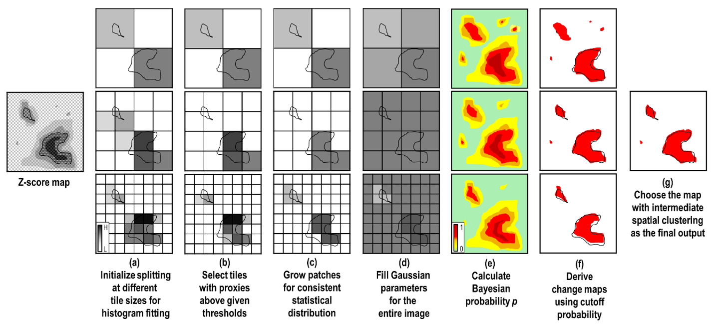
The study designs the sophisticated algorithm called the Growing Split-Based Approach (GSBA) to detect changes regardless of the image’s spatial resolution, swath size, and the target’s geospatial distribution.
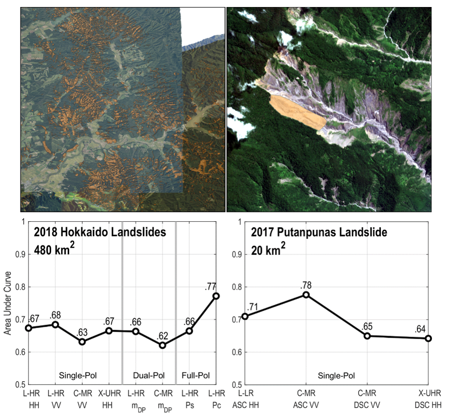
The study evaluates the performance of different SAR data properties on landslide detection, including radar wavelengths, spatial resolutions, polarizations, and viewing geometry. We discuss the detection performance in two landslide cases, the earthquake-triggered landslides due to the 2018 Hokkaido Eastern Iburi Earthquake in Japan, and the rainfall-triggered landslide caused by the 2017 heavy rain in the catchment of Putanpunas River, southern Taiwan.

In the 2018 Hokkaido case, the high-resolution L-band scattering powers have the best performance in landslide detection, while the medium-resolution C-band data have the worst. However, in the 2017 Putanpunas case, the medium-resolution C-band data work better than the others. The comparison indicates the detection performance of different SAR data are relevant to the types of landslides and land covers (forest or bare soil).
Participants: Yunung Nina Lin and Yi-Ching Chen (Academia Sinica)
Full article: https://doi.org/10.3390/rs14102444
May 2022