From a City to a Country: Multi-scale SAR Processing Techniques and Applications
Recruiting Information
We recruit undergrad, master, PhD students and post-doctoral researchers all the time!
If you are interested, please contact Dr. Lin directly.
Recommended background (but not limited to):
1. Fundamentals of Active Remote Sensing (NTNU, Spring 2025)
Pre-requirement (optional): Linear Algebra
2. Fundamentals of Active and Passive Remote Sensing (TIGP-ESS, Fall 2023)
Pre-requirement (optional): Linear Algebra
3. Synthetic Aperture Radar Integrated Data Analysis (NTU, Sprig 2023, Fall 2025)
Pre-requirement (mandatory):
Fundamentals of Active and Passive Remote Sensing (or equivalent)
Linear Algebra
Programming
4. Special Topics on Synthetic Aperture Radar (TIGP-ESS)
5. SAR Workshop (public workshop)
One-week workshop offered annually in winter (January or February)
1. 2022中研院地球所院區開放影片欣賞-穿雲透雨雷達現:透視地表祕密的合成孔徑雷達 (in Chinese)
https://www.youtube.com/watch?v=wZGdlenFhvE
2. Performance Study of Landslide Detection Using Multi-Temporal SAR Images
https://www.youtube.com/watch?v=zu6LtISTkig
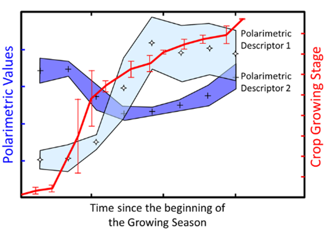
1. Beyond InSAR: SAR Environmental Intelligence (NEW)
For thirty years, SAR's primary application was DInSAR for deformation monitoring.
However, a recent shift towards environmental issues has spurred new long-wavelength
(L/P-band) missions like ALOS-4, BIOMASS, NISAR, and ROSE-L. These missions
utilize penetration to extract signals from vegetation and soil, bringing agriculture and
forestry applications—previously overlooked in Taiwan—back to the international stage.
The lab has started to explore the wide range of applications of SAR image in retrieving
environmental information, including trees, crops, and vegetation. These brand new
fields await more involvement of the young generation!
Related project:
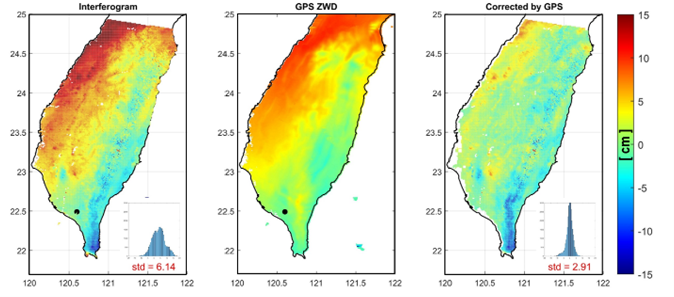
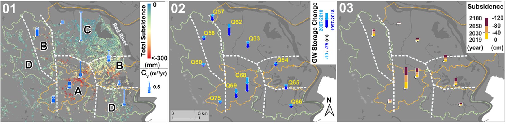
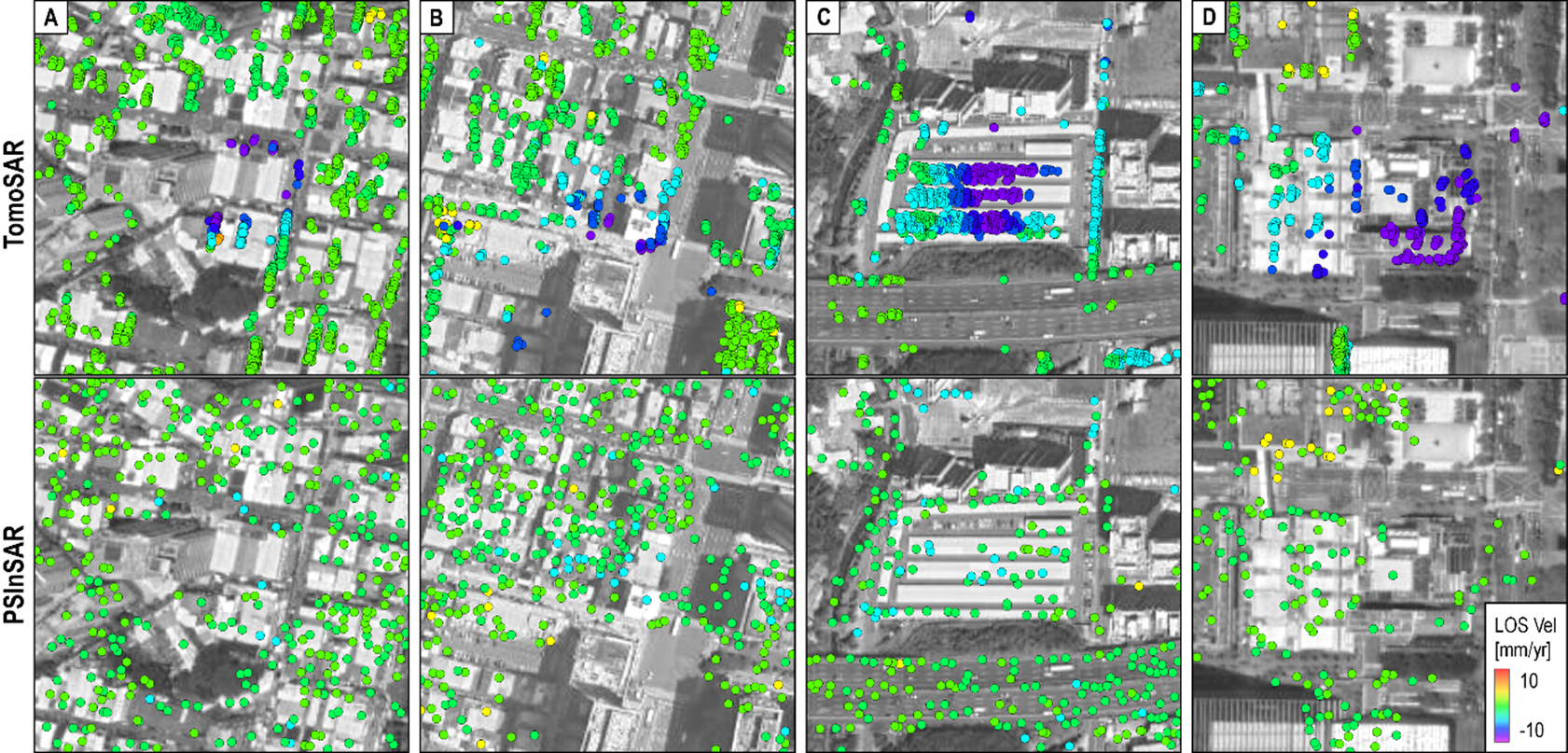
2. Deformation Monitoring and Modeling with InSAR
My team implements multiple InSAR processing flows on the Hight Performance Computing (HPC) environment within the Institute of Earth Sciences, Academia Sinica. The processing flows established include small baseline subsets approach, persistent scatterer approach and phase linking approach. We use these methods to monitor and model different types of natural hazards and tectonic deformation. We also open up the HPC to students and collaborators from various universities/institutes.
Related project:
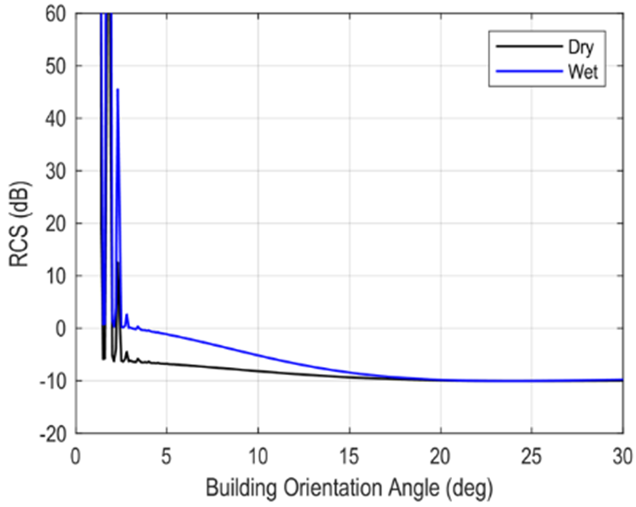
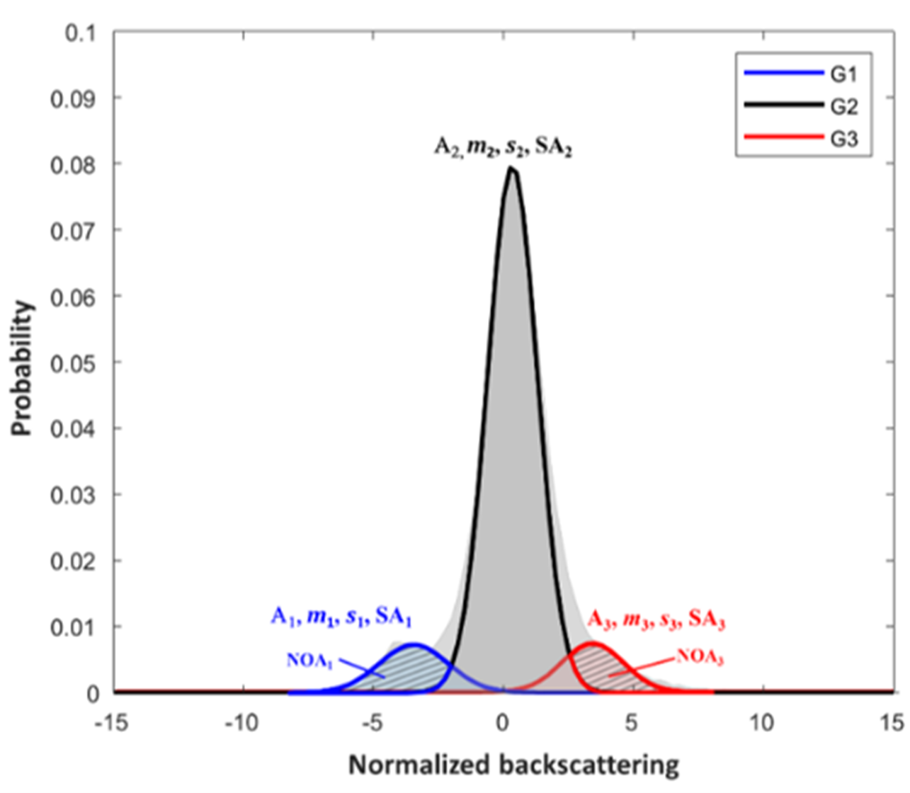
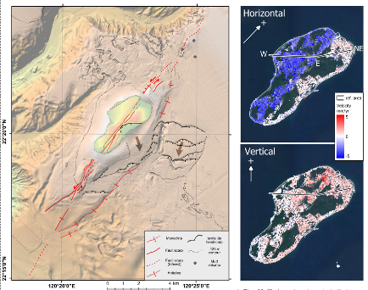
3. SAR-based Change Detection
We develop the Growing Split-Based Approach (GSBA) algorithm for automatic change
detection based on multi-temporal Synthetic Aperture Radar (SAR) imagery. The
detection kernel is the Bayesian probability generalized to a three-class problem rather
than the conventional two-class problem. GSBA is statistically robust and
computationally efficient, with a user-friendly driver file for operational applications. It can
also be utilized for other scenarios, such as changes associated with landslides.
Related project:
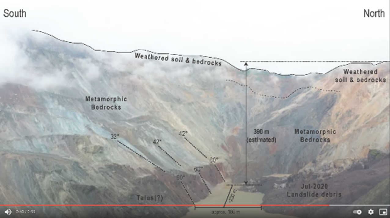
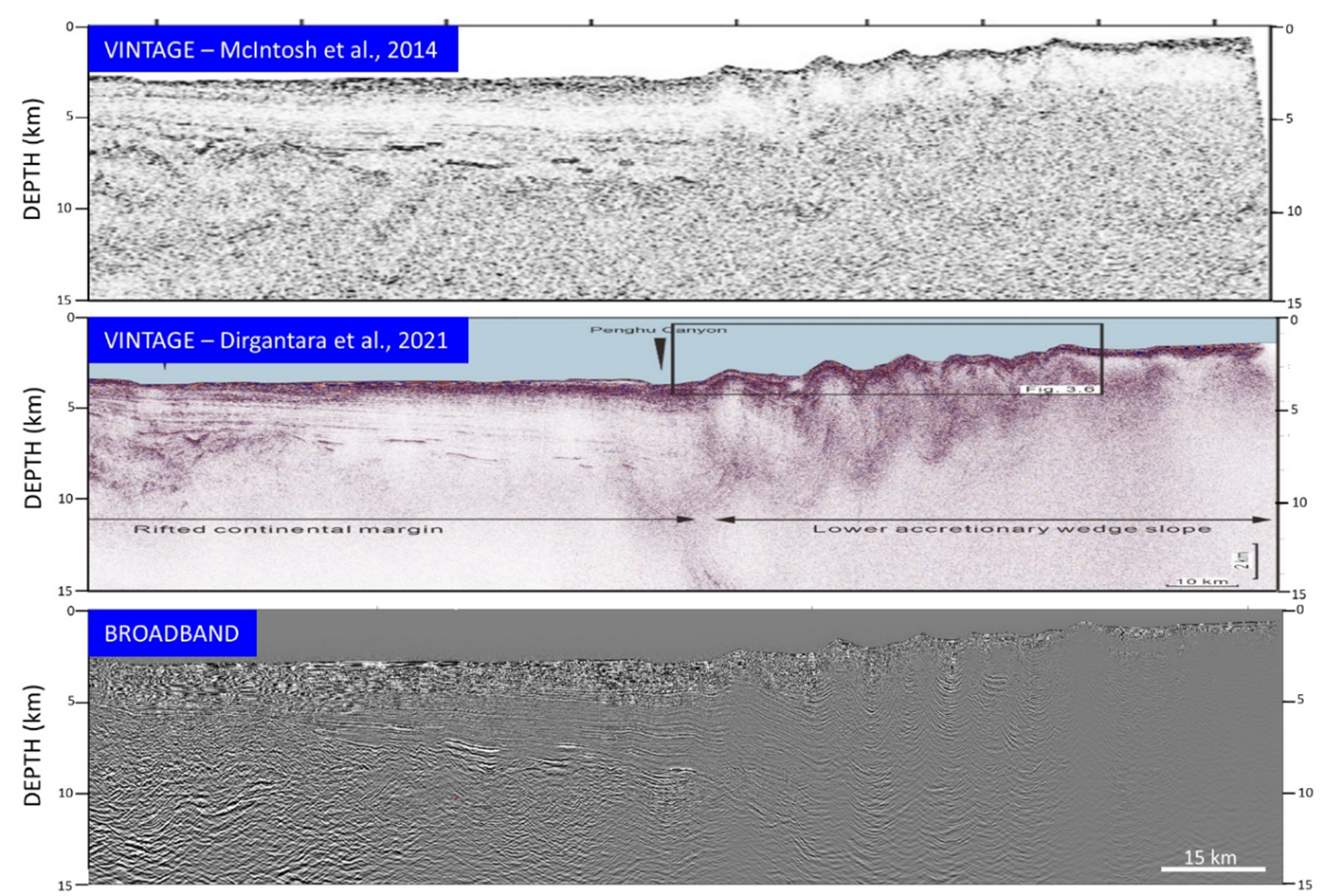
4. Mobile Shales in Active Orogeny
There are many active mud volcanoes onshore and offshore southwestern Taiwan, yet the source area at depth is usually not clearly imaged. We utilize the industry-level seismic processing software, Geovation, to reprocess long-offset seismic data in order to figure out the geometry and physical properties associated with the patches of mobile shales at depth. The goal is to unravel the role mobile shales play in an active orogenic
belt.
Related project:
For more information about the lab, please see More ▼