Participants: Yunung Nina Lin (Academia Sinica) and Yu Wang (National Taiwan University)
In July 2020, one of Myanmar’s most devastating landslides occurred in the Wai Khar open-pit jade mine in the Hpakant township in the northern state of Kachin, Myanmar. At least 170 jade miners were dead in this incident. Based on the multi-sensor satellite data, the primary cause of the incident was attributed to the seepage failure which caused continuous instability on the slope, rather than extreme weather. We suggest that governments should improve mining site regulations and enforce proper management. Furthermore, the proposed method in this study is recommended for the long-term monitoring of mining sites.
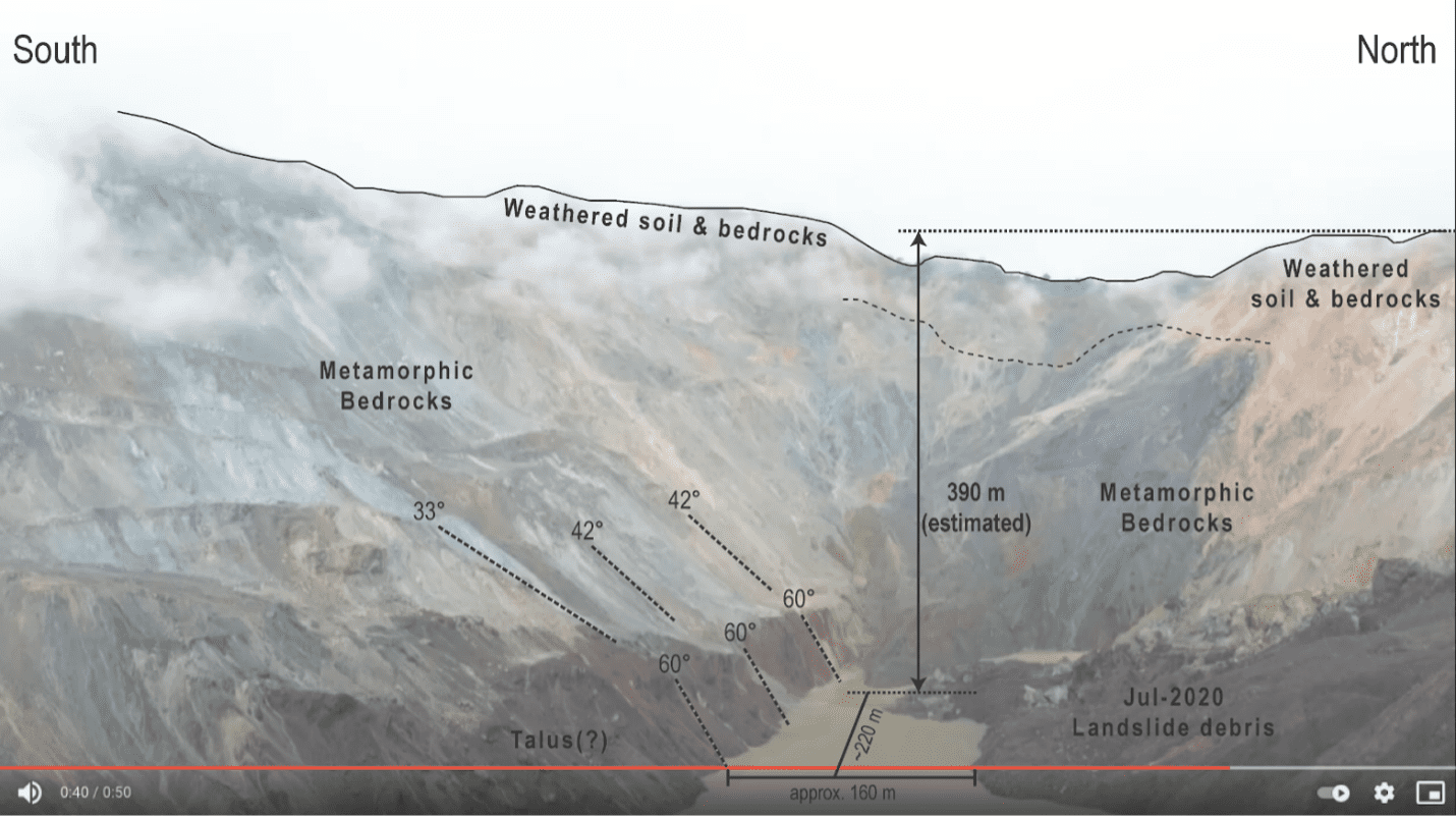
The UAV-based post-landslide footage can help the researcher understand remote mining sites' geometric and geologic properties.

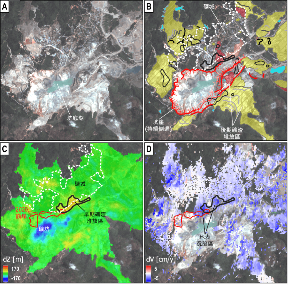
Based on the integration of optical images (A), landform evolution of the mining site (B), temporal elevation differences (C), and the pre-event (1 year) deformation (D), we can reconstruct the geometry of the mining site in recent 20 years.
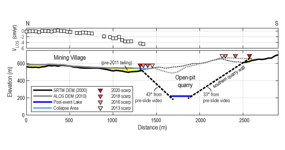
This profile of 2D reconstruction shows that about 180-meter thick of tailings were stored at the top of the steep wall (~45° slope). Continuous water expulsion from the tailings eventually results in the slope instability.
News report in Nature:
https://www.nature.com/articles/d41586-021-01740-2
Chinese report in Taiwan Earthquake Research Center Newsletter
https://tec.earth.sinica.edu.tw/upload/publications/html/202109/33_04.html
More information:
https://www.sciencedirect.com/science/article/pii/S0924271621001489
Full Article: https://doi.org/10.1016/j.isprsjprs.2021.05.015
June 2021