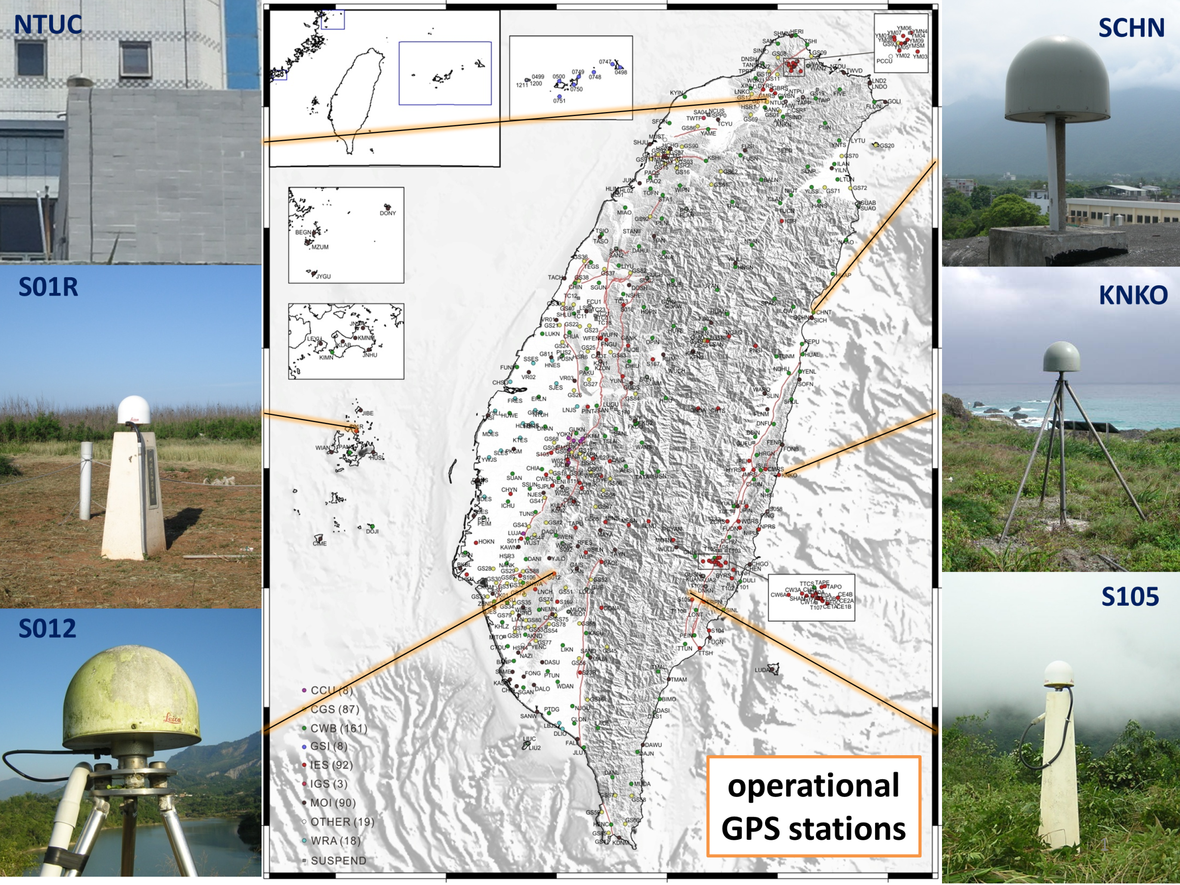
Since the early 1990s, continuous GPS stations have been progressively established across Taiwan. Following the 1999 Chi-Chi earthquake, a national five-year program significantly expanded the network, leading to over 200 stations by 2005. Today, more than 450 stations operate continuously, with over 520 stations in total, providing a robust foundation for crustal deformation monitoring.
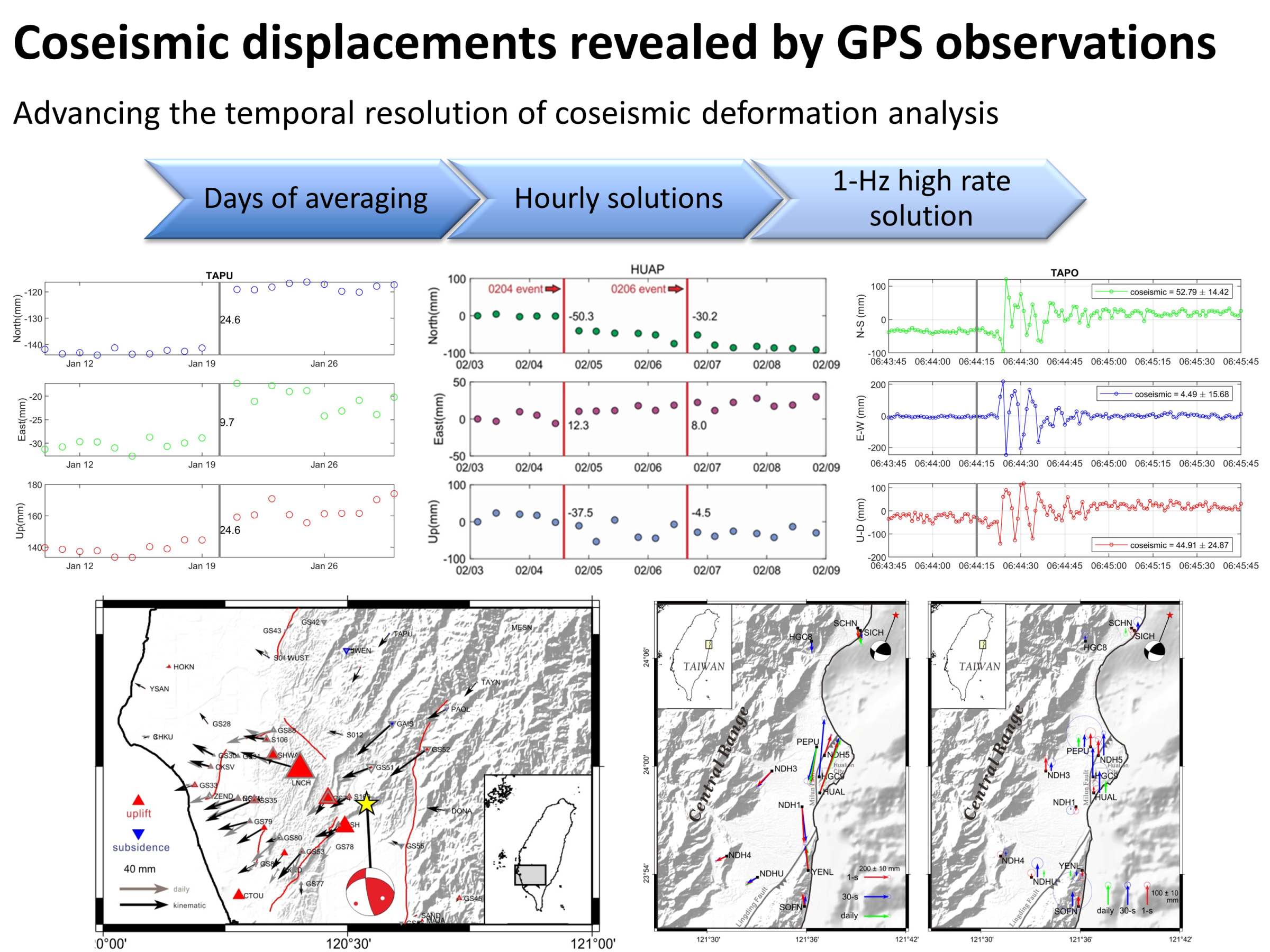
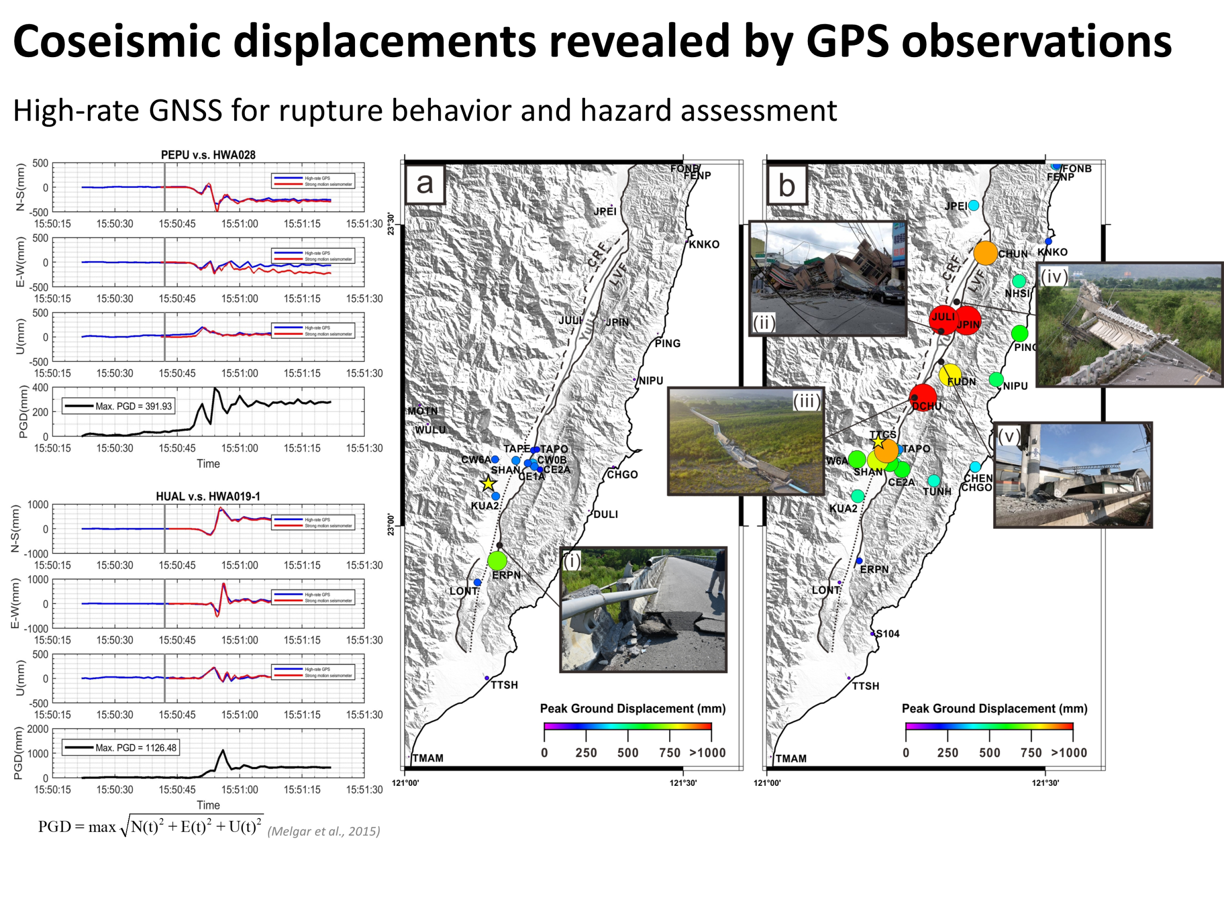
My research focuses on improving the temporal resolution of coseismic deformation using GNSS data. I progressively refine solutions from daily to hourly and further to high-rate (1 Hz) positioning, allowing increasingly detailed observations of ground motion. By comparing 1 Hz GNSS results with strong-motion seismic waveforms, I find excellent agreement between the two datasets, demonstrating that high-rate GNSS can reliably capture rapid ground motion during earthquakes.
High-rate (1 Hz) GNSS displacement data provide near real-time measurements of ground motion. These data provide critical information for rapid hazard assessment and earthquake characterization. My work helps bridge geodesy and seismology for real-time applications.
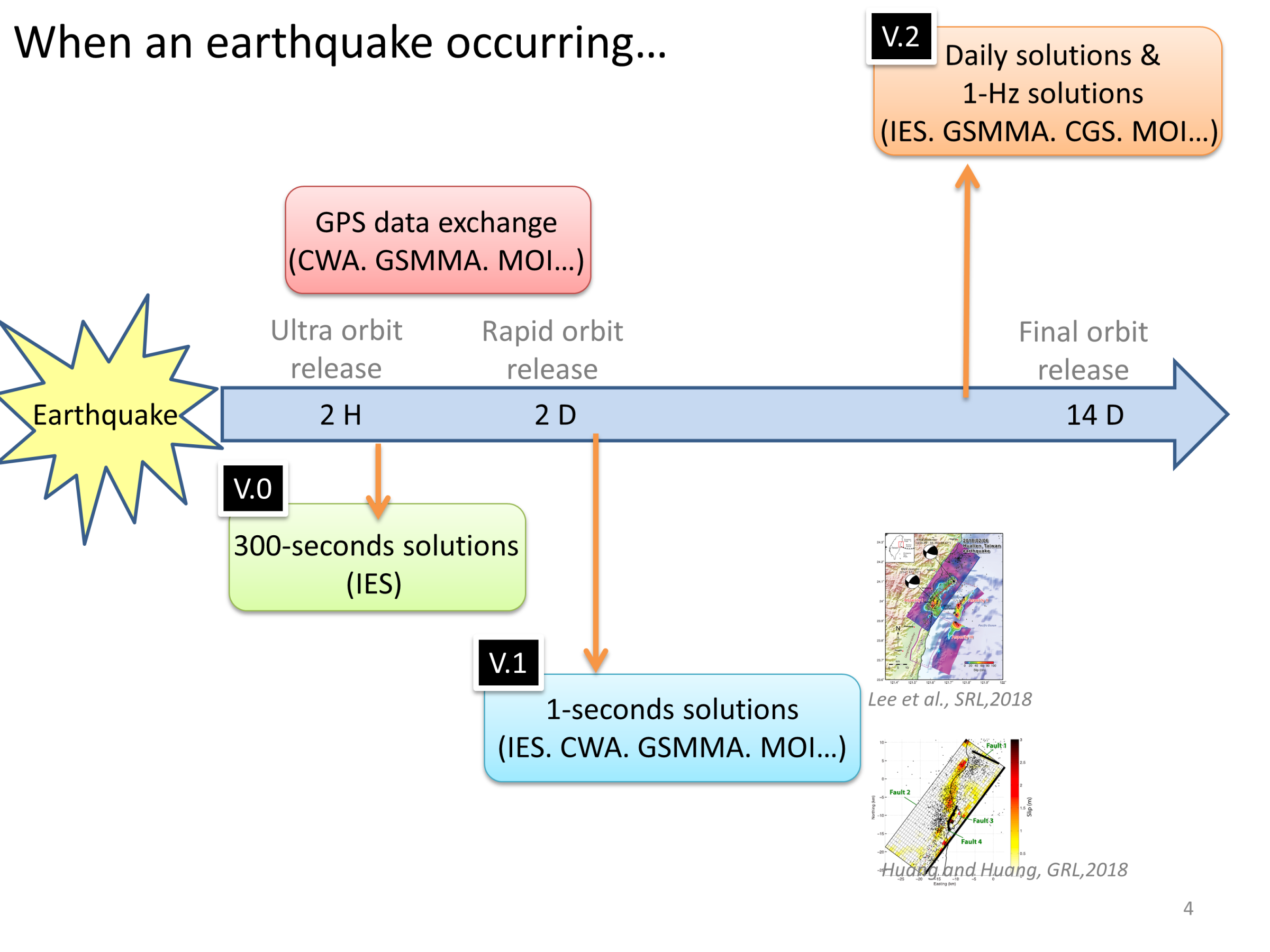
When an earthquake occurs, my goal is to obtain reliable deformation results as quickly as possible. I integrate GNSS data from multiple agencies into a unified processing workflow. By generating multi-rate solutions—from 300-second to 1-second time series—I am able to rapidly produce initial deformation estimates and progressively refine them. This approach supports both timely earthquake response and high-quality scientific analysis.
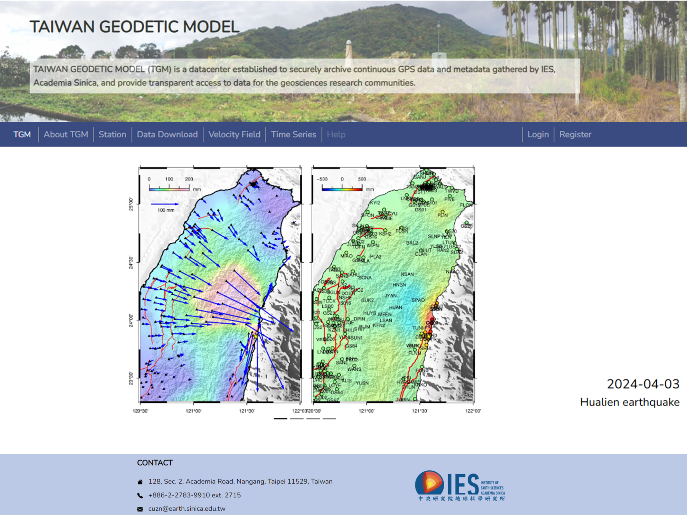
The Taiwan Geodetic Model (TGM) is a platform that integrates GNSS data from multiple agencies into a unified processing framework. It provides standardized and high-quality geodetic products for Taiwan, supporting both scientific research and near real-time earthquake monitoring. More information is available at: https://tgm.earth.sinica.edu.tw/